Jamar RAC Geo II DMI
The RAC-GEO-II includes all the benefits of the RAC-Plus-I while also allowing you to save your distances, coordinates and customized ID markers in the unit's expansive memory. Download data into the RACPro Software to quickly generate reports, graphs, maps, spreadsheets and more. The RAC-GEO-II real-time data collection option even let's you measure and collect data in real time, on the fly!
The RAC-GEO-II is the most accurate and powerful GPS DMI on the market. The RAC-GEO-II is built to last, with high grade components and a proven industry track record. Skip the process of trying those cheaply made, short lived units made by other brands. Let our decades of DMI development experience work for you. Along with our knowledgeable sales/support staff, JAMAR also maintains two full-time DMI experts on staff (with a combined experience of 40+ years).
GPS Distance Measuring
Built-in GPS receiver, accurate up to 1 foot per one thousand feet. No external sensor required. Magnetic Sensor and Modular Sensor can be added to increase accuracy even further, if needed.
Memory
Store up to 400,000 events in memory (nonvolatile RAM NVRAM).
Ideal for inventory applications, identifying signs, guide rails, pavement markings, intersections, railroad crossings or other highway features.
Data Output
Download data into JAMAR's RACPro Software. The downloaded data contains the memory location, event code, GPS coordinates, distance, interval distance, time and speed for each event.
Record Accurate Distances along with GPS Coordinates
Store up to 30 hours of continuous GPS data, at one second intervals, while recording roadway distance in the RAC-GEO-II's internal memory. Using this powerful inventory tool, you can record road features (intersections, bridges, signs, guide-rail, etc.) along with their distance and GPS coordinates.
Several Data Retrieval & Processing Options
Read your data from the RAC-GEO-II display, save data in the unit's internal memory, download data into the RACPro Software, collect data in Real-Time (using RACPro). Read data while the vehicle is stopped or moving.
Unmatched GPS Recording Accuracy
The RAC Geo II uses a GPS receiver which incorporates the Wide Area Augmentation System (WAAS) for improving accuracy of GPS signals. WAAS uses a correction signal created by a collection of 25 land-based stations that are spread out across North America. This correction signal is then broadcast from specialized communication satellites.
With WAAS enabled, our 66 channel GPS receiver capability allows 2D GPS accuracy of approximately 2 meters. Without WAAS, depending on the location in the continental US and satellite accessibility, horizontal GPS accuracy is approximately 6 meters. This, along with the RAC-GEO-II's distance accuracy of up to+/- 1 foot per one thousand feet provides unequaled data collection capabilities.
Description
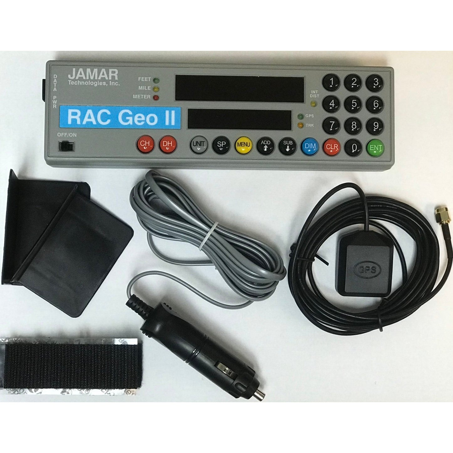
Includes: RAC-GEO-II, mounting brackets, auto adapter power supply, external GPS antenna. Optional RACPro software sold separately.