How Tilt Compensated Products Are Boosting Construction Productivity

The problem for so many land surveying companies and construction crews today is finding ways to free up the existing workforce and cut down on the time it takes to carry out tasks.
Recent advancements in geomatic technology are revolutionizing the efficiency and accuracy of land surveying assignments with impressive results.
Not All Modern Surveying Equipment Is Built Equal
Tilt compensation sensors are changing the way surveying is performed, particularly with products featuring Inertial Measurement Unit (IMU) technology. In this respect, Leica Geosystems is leading the charge.
Imagine conducting a survey without having to level the bubble or even hold the prism pole plumb. One person can now perform tasks that once required a seasoned crew chief and a skilled rodman.
This autonomy is achievable when you have calibration-free surveying equipment capable of automatic pole height readings and automated target searches.
These advantages result in fewer total station setups and offset calculations even when surveying around buildings and other tricky locations.
Today’s innovative equipment allows operators to perform surveying tasks quicker with less concern about calibration errors or disruptions caused by large obstacles, heavy traffic or other work crews nearby.
Two products are frequently cited as game changers in the construction and surveying industries.
The AP20 AutoPole
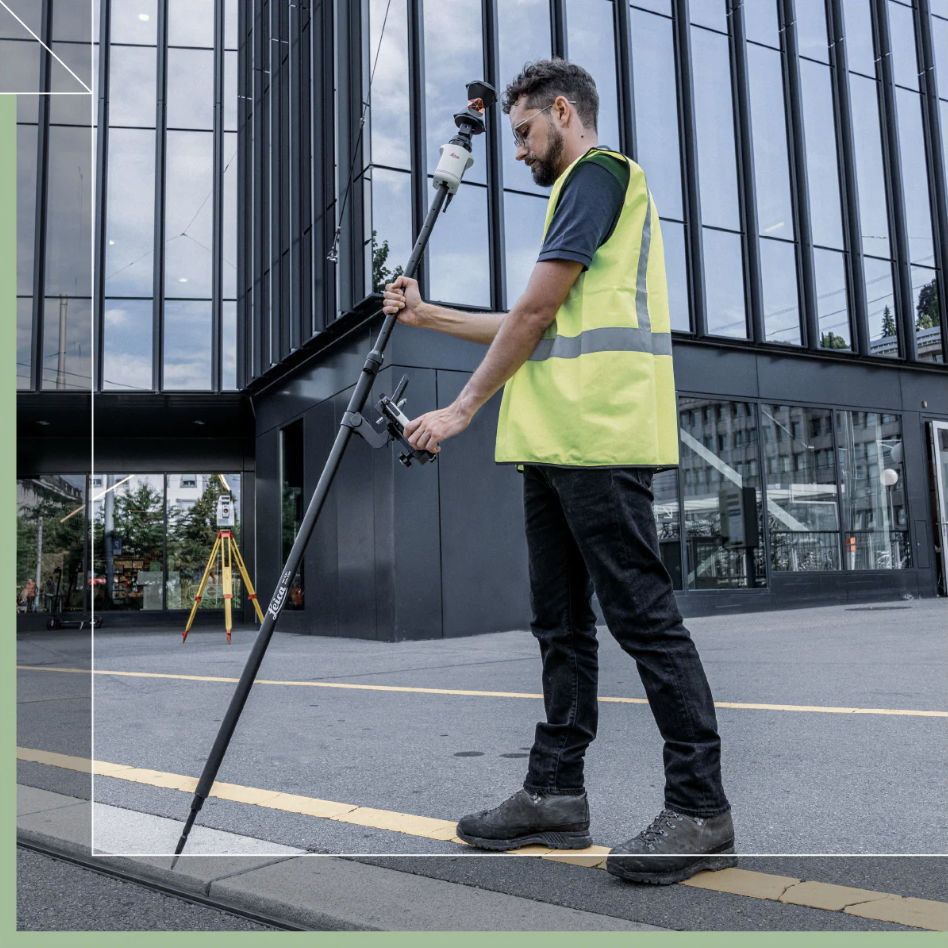
Using the latest smart system sensor technology, the Leica AP20 AutoPole works with automated total stations for improved efficiency and accuracy during surveying fieldwork.
Operators are no longer restricted by having to rely on the correct vertical placement of the rod. Tilt-compensated measurements offer greater flexibility for data collection, especially around building corners. Being able to angle the top of the AutoPole away from obstructions is a big time saver. The Leica AP20 empowers users to effortlessly lay out survey points, even in challenging locations such as ceilings, and to accurately capture 3D points in space.
With its built-in Target ID technology, The AP20 AutoPole negates any concerns about locking onto the wrong target or having to re-enter information into your software manually.
Human error, such as misreading pole heights, contributes significantly to surveying mistakes. The Leica AP20 addresses this issue by removing the need for manual height readings and inputs into field software, reducing the likelihood of errors or omissions. With automatic detection and updating of prism height changes, operators can save time and ensure accuracy seamlessly.
This smart system significantly reduces the time spent in harsh weather, heavy traffic areas, sites with multiple work crews, and locations with structural obstacles.

The World's First Tilt Compensating GNSS Sensor
Not only is the Leica GS18 T the first of its kind, but it is also the fastest GNSS RTK rover on the market! The 'T' denotes tilt.
Unlike conventional sensors, the Leica GS18 T does not use a magnetometer to determine the tilt direction. It is not affected by magnetic disturbances caused by power lines, buildings, metal fences, vehicles and bridges.
The GS18 T RTK rover works well with Leica Captivate software, making data management easy and predictable. Captivate captures field data while Leica Infinity software processes it in the office. This seamless transfer of information speeds up the work and helps keep projects on schedule.
Not constantly worrying about recalibration or levelling the bubble will drastically reduce your survey times.
Faster, Easier and More Accurate
Tight schedules, budget constraints, and labour shortages of skilled workers are some of the problems facing surveyors and construction crews everywhere. These shortfalls make everything from topographic surveys to environmental impact statements more challenging.
Lecia's range of innovative geomatics products empowers companies across Western Canada by simplifying their tasks.
With offices in Prince George, Vancouver, Edmonton, and Calgary, Spatial Technologies supplies the tools and equipment to boost productivity and ensure reliable accuracy during survey work.
Are you interested in updating your analogue approach? Our team is prepared to assist.
About Spatial Technologies
Spatial Technologies is built upon excellence. Our team of technical representatives includes experienced technicians, Professional Land Surveyors, and Professional Engineers. Spatial Technologies is an exclusive sales and authorised warranty service centre for Leica Geosystems solutions in Western Canada.
Spatial Technologies sells, services and rents a complete range of surveying equipment, supplies and tools ranging from basic construction lasers, advanced GNSS and robotic survey instruments, UAVs and 3D laser scanners.
Our mission is to be the first-choice supplier of top-quality measurement solutions and services to the geomatics, construction, engineering, BIM, machine control and UAV mapping community. We want to be considered your partner and not just a supplier.
Our goal is to develop a reputation of mutual respect, trust and integrity with our business partners, suppliers, and employees while providing the tools to enhance our client's business. We will accomplish these goals through our dedication to customer service.
