SurveyTools™ for BricsCAD® is an all-in-one solution for surveying specific workflows, combining industry-leading technology that accelerates productivity while ensuring data integrity.
Why SurveyTools™?
-
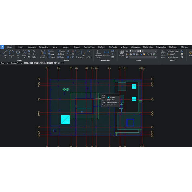
All-In-One Solution: Combine surfacing and contour creation in the same environment used for drafting the final deliverable, reducing workflow friction.
-
Accelerate Productivity: Enhance productivity with industry-specific tools created by surveyors for surveyors, complemented by BricsCAD®’s AI-driven drafting tools.
-
Trusted Brands: Collaborative effort of three prominent brands—Leica Geosystems, MicroSurvey, and Bricsys®—providing a Hexagon-based solution for reliable data compatibility.
-
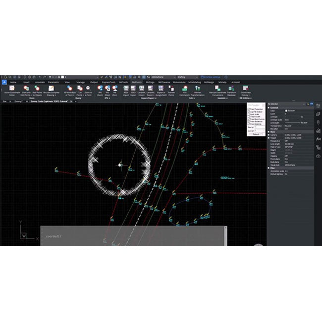
Survey Specific Tools: Tools for linework and block generation from point descriptions, including import options for linework created in the field, COGO, surveying focused dynamic labeling, and geodetic tools.
-
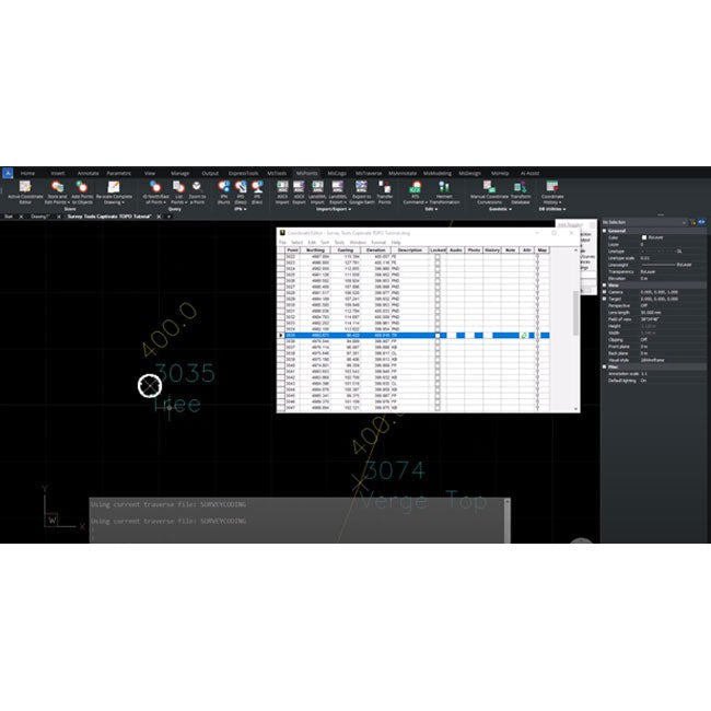
Data Integrity: Offers a complete audit trail for values derived from computations and field data, with intelligent data utilization for creating accurate and precise CAD deliverables.
Features:
- Basic lot and subdivision creation tools
- Cadastral annotation tools
- MicroSurvey LISP extension to allow the creation of custom routines
- Lot Closures (map check) and metes and bounds descriptions
- Import/Export ASCII, LandXML and geodetic point files
- Staking Reports and QA tools
- Smart Lines, arcs, polylines and labels
- Dynamic spreadsheet view of point database and traverse files
- Geodetic tools, ground-to-grid scaling, KML export
- Import shape files and GIS data
- Streamlined COGO tools
- Smart points with built-in point protection and audit trail
- Building Library and house placement routines
- Advanced survey computation tools: Best-fit/Helmert’s/Adjustments
- Field to Finish automated diagramming
- Traverse editing and adjustment
- WMS support: load aerial imagery and maps from web mapping services
- Background aerial imagery and maps from Microsoft Bing