See More. Reach Deeper.
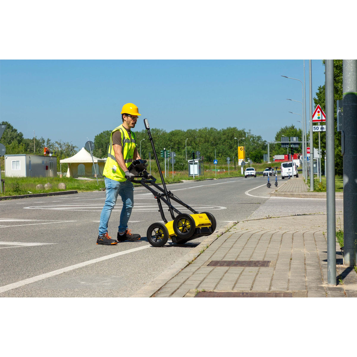
The Leica DS4000 Utility Detection Radar is an advanced ground penetrating radar (GPR) system designed to help professionals locate underground utilities with exceptional clarity, resolution, and depth. Powered by Leica Geosystems’ patented Equalised Scrambling Technology (EsT), the DS4000 can identify underground assets up to 60% deeper than traditional systems, helping reveal utilities at both shallow and deeper levels—including difficult-to-detect objects such as fibre optic cables.
Designed for utility detection, construction, surveying, and infrastructure applications, the DS4000 provides a clear overview of underground pipe and cable networks before excavation begins. Accurate utility location helps improve worker safety, reduce the risk of excavation strikes, and minimize disruption to surrounding communities.
Advanced EsT Detection Technology
At the heart of the DS4000 is Leica’s patented EsT technology, engineered to deliver high-quality data across an extended depth range. According to Leica Geosystems, EsT increases penetration depth by 40% to 60% compared with traditional devices, while providing high-resolution results from a single system.
The antenna can also be easily switched between HH and VV polarization, allowing operators to optimize performance for different detection requirements.
Built for Efficient Fieldwork
Weighing approximately 20 kg (44 lb), the DS4000 features a lightweight, modular, and compact design that makes data collection and transportation easier for a single operator. Its foldable handlebar simplifies deployment and storage, while the large handle provides a secure grip for improved maneuverability. The height-adjustable dual-frequency antenna mounting system helps the unit negotiate obstacles and adapt to varying field conditions.
Quick Scan Mode is designed to streamline field operations, helping operators collect data faster while reducing time and associated costs. Hot-swap power technology enables uninterrupted data acquisition throughout the workday.
Integrated Field & Post-Processing Software
The DS4000 works with Hexagon software solutions uMap and IQMaps. uMap provides field data collection and management capabilities, including Quick Scan mode, real-time on-site marking and digitalization of detected anomalies, and the ability to create and finalize reports directly in the field. IQMaps provides advanced post-processing and analysis of GPR data.
Key Features
-
Patented EsT (Equalised Scrambling Technology) for extended detection range
-
Up to 60% deeper detection than traditional systems
- High-resolution detection at shallow and deeper levels
- Designed to detect difficult underground objects, including fibre optic cables
-
20 kg (44 lb) lightweight, modular construction
-
Switchable HH/VV antenna polarization
-
Quick Scan Mode for faster field operations
-
uMap field software for real-time marking, digitalization, and reporting
-
IQMaps software for advanced GPR post-processing
- Height-adjustable antenna system
- Hot-swappable power supply for uninterrupted data acquisition
- Foldable handlebar for easier transportation and storage
-
External positioning support for mounting GNSS or a Total Station reflector
- Optional rugged off-road wheels and hard shipping box