


- Regular price
- $0.00
- Sale price
- $0.00
- Regular price
-
- Unit price
- per
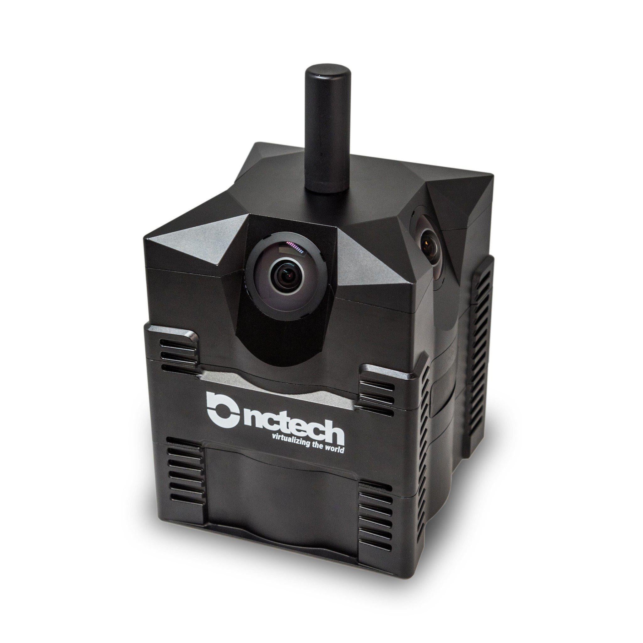
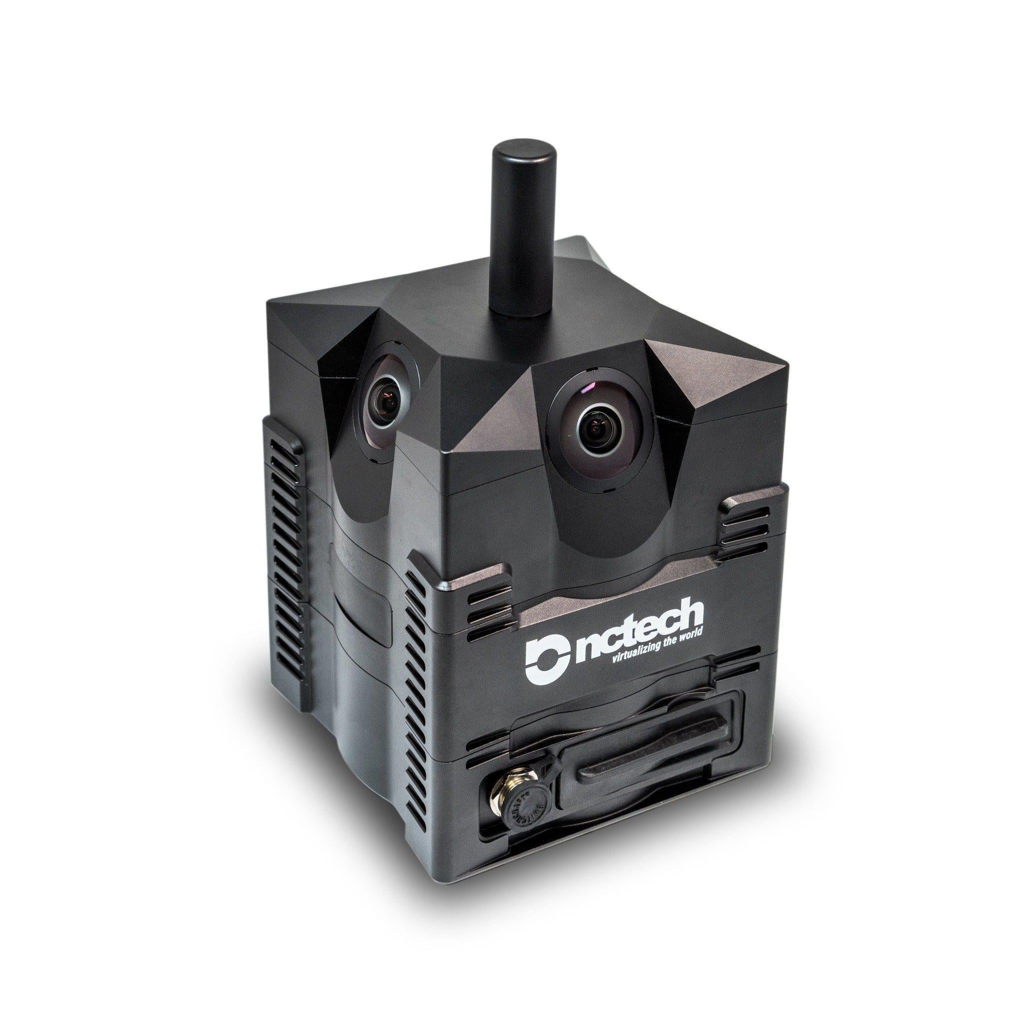
iSTAR Pulsar+ compact mobile mapping system builds on the success of the groundbreaking iSTAR Pulsar, providing industry-leading 11K 360° imaging in an accessible form. However, iSTAR Pulsar+ boasts significant new features that enable you to fully control the processing, storage and use of your data.
Features
Geo-referenced images
GPS coordinates are embedded within every image for effortless, automatic image positioning within GIS and other location-based processing applications. Corresponding GPS and IMU txt files enable accurate image positioning within 3rd party workflows.
Local processing
Copy encrypted data via USB-C into Immersive Studio for local batch processing, eliminating cloud dependency and ensuring total data control.
NCTech SDK
Harness the power of Immersive Studio for Windows to effortlessly process all your data at the click of a button. Integrating the NCTech SDK guarantees the highest levels of data portability, ensuring streamlined processing directly within your own applications.
Powerful integrations
iSTAR Pulsar+ allows for post-processed accurate time synchronisation with external GPS and IMU sensors. This provides the highest levels of positional accuracy, adding further value to existing hardware without the constraints of physical connectivity.
Use Cases
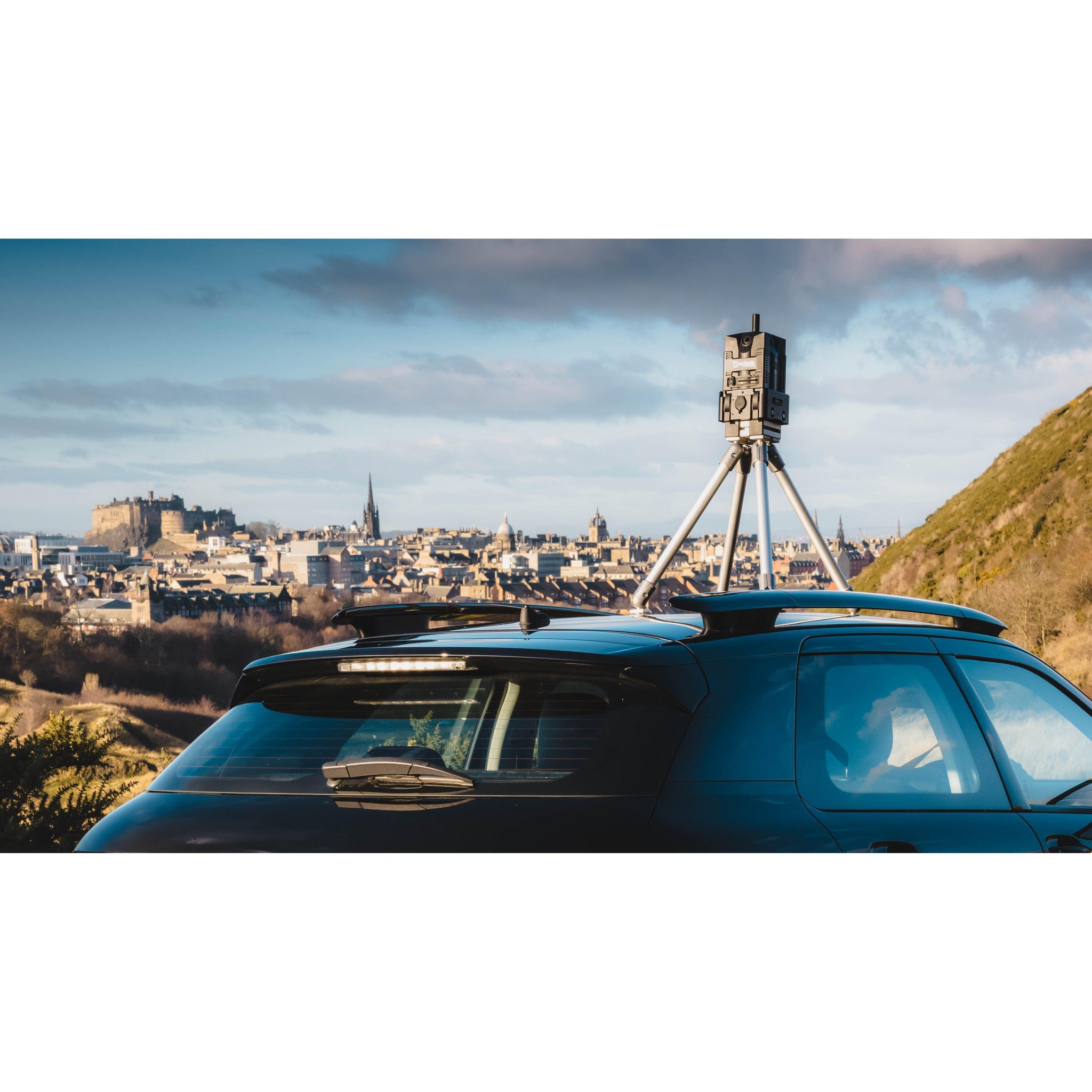
Road condition surveys
High-resolution output 360° imagery allows road conditions to be assessed in detail, e.g. potholes, cracks etc. Georeferenced imagery provides lat/long locations of every image Optional semantic segmentation analysis allows identification of soft verges, tarmac and concrete
Waterways documentation
Visually document side banking and vegetation growth iSTAR Pulsar+’s ruggedized IP64 rated exterior protects against moisture ingress Railway documentation Improve track maintenance efficiency with visual documentation Rugged and robust mounting options give you flexibility to suit your operational requirements
Construction progress documentation
Increase documentation efficiency by monitoring the construction progress of sites of any scale, inside and out. Backpack walkthrough of sites ensures large area coverage in minimal time
Disaster response documentation
Swiftly identify the most affected areas for targeted investment of resources Use captured data to improve best practice in relief efforts
Integrated solutions
Integration allows for the capabilities of iSTAR Pulsar+ to be utilised and enhanced for specialised use-cases iSTAR Pulsar+ allows automated sync with external devices such as GPS, IMU and LiDAR to provide the highest level of positional accuracy
iSTAR Pulsar+ compact mobile mapping system builds on the success of the groundbreaking iSTAR Pulsar, providing industry-leading 11K 360° imaging in an accessible form. However, iSTAR Pulsar+ boasts significant new features that enable you to fully control the processing, storage and use of your data.
Features
Geo-referenced images
GPS coordinates are embedded within every image for effortless, automatic image positioning within GIS and other location-based processing applications. Corresponding GPS and IMU txt files enable accurate image positioning within 3rd party workflows.
Local processing
Copy encrypted data via USB-C into Immersive Studio for local batch processing, eliminating cloud dependency and ensuring total data control.
NCTech SDK
Harness the power of Immersive Studio for Windows to effortlessly process all your data at the click of a button. Integrating the NCTech SDK guarantees the highest levels of data portability, ensuring streamlined processing directly within your own applications.
Powerful integrations
iSTAR Pulsar+ allows for post-processed accurate time synchronisation with external GPS and IMU sensors. This provides the highest levels of positional accuracy, adding further value to existing hardware without the constraints of physical connectivity.
Use Cases
Road condition surveys
High-resolution output 360° imagery allows road conditions to be assessed in detail, e.g. potholes, cracks etc. Georeferenced imagery provides lat/long locations of every image Optional semantic segmentation analysis allows identification of soft verges, tarmac and concrete
Waterways documentation
Visually document side banking and vegetation growth iSTAR Pulsar+’s ruggedized IP64 rated exterior protects against moisture ingress Railway documentation Improve track maintenance efficiency with visual documentation Rugged and robust mounting options give you flexibility to suit your operational requirements
Construction progress documentation
Increase documentation efficiency by monitoring the construction progress of sites of any scale, inside and out. Backpack walkthrough of sites ensures large area coverage in minimal time
Disaster response documentation
Swiftly identify the most affected areas for targeted investment of resources Use captured data to improve best practice in relief efforts
Integrated solutions
Integration allows for the capabilities of iSTAR Pulsar+ to be utilised and enhanced for specialised use-cases iSTAR Pulsar+ allows automated sync with external devices such as GPS, IMU and LiDAR to provide the highest level of positional accuracy
No Video added yet.

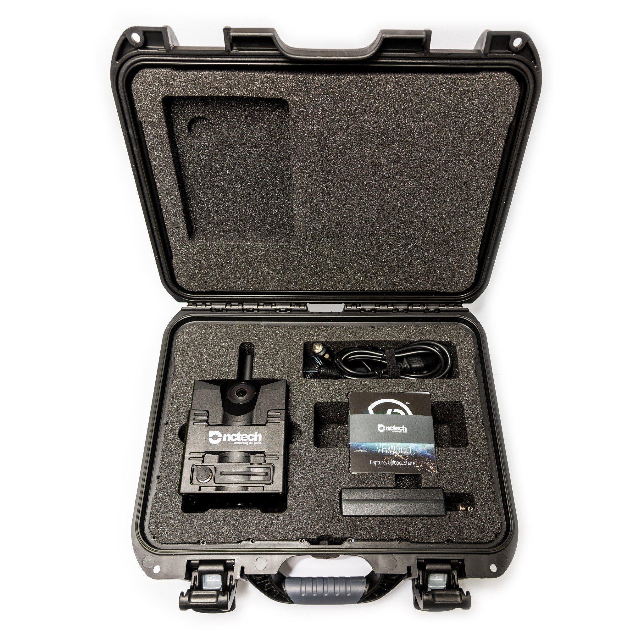
No What's included added yet.
- Choosing a selection results in a full page refresh.
- Press the space key then arrow keys to make a selection.
